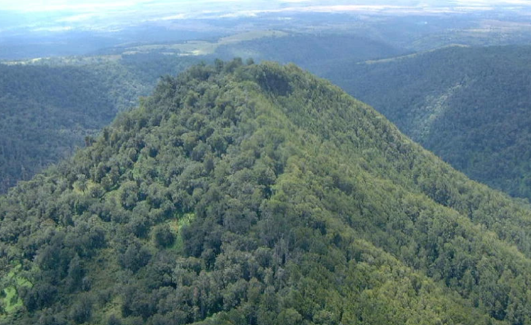
Canada is one of the world’s great forest nations. The country has about 369 million hectares of forest, representing roughly 9% of the world’s total forest area. Canada’s forests stretch from the Atlantic provinces through the boreal forests of Quebec, Ontario, and the Prairies to the enormous temperate and coastal forests of British Columbia and the northern forests of Yukon and the Northwest Territories.
Forest cover is not distributed evenly across the country. British Columbia, Ontario, Quebec, Alberta, and the northern territories contain enormous areas of forest, while Prince Edward Island and Nunavut have much smaller forest areas. The percentage of a jurisdiction covered by forest can also tell a different story from total forest area: a smaller province such as New Brunswick can have a very high proportion of its land forested even though its total forest area is much smaller than Quebec or British Columbia.
It is also important to distinguish forest area from tree cover. Canada’s official forest statistics use a specific definition of forest based on factors such as tree cover, land use, and minimum area. Natural Resources Canada reports that Canada’s forest area has remained relatively stable over recent decades, while tree cover itself changes more dynamically because of wildfire, insects, harvesting, regeneration, and other disturbances.
Forest Cover by Province and Territory: At a Glance
The following figures use Canada’s National Forest Inventory figures for forest land by jurisdiction. Because the underlying province-and-territory table is based on the CanFI-2001 inventory, the hectare figures should not be confused with the newer national estimate of 369 million hectares. The table remains useful for comparing the relative distribution of forest land among jurisdictions.
| Province or territory | Forest land | Approx. forest land as share of jurisdiction* |
|---|---|---|
| British Columbia | 57.91 million ha | ~61% |
| Quebec | 73.36 million ha | ~49% |
| Ontario | 53.76 million ha | ~53% |
| Alberta | 27.72 million ha | ~42% |
| Saskatchewan | 20.04 million ha | ~32% |
| Manitoba | 18.97 million ha | ~29% |
| Newfoundland and Labrador | 10.73 million ha | ~28% |
| Yukon | 7.88 million ha | ~16% |
| New Brunswick | 6.09 million ha | ~83% |
| Nova Scotia | 4.24 million ha | ~77% |
| Northwest Territories | 28.35 million ha | ~21% |
| Prince Edward Island | 0.27 million ha | ~40% |
| Nunavut | 0.82 million ha | <1% |
| Canada | 310.13 million ha | — |
*Approximate percentages are calculated from the historical forest-land and jurisdiction-area data and are intended for comparison rather than as current official estimates. The underlying inventory table dates to 2001.
1. Quebec
Quebec has the largest forest-land area among Canada’s provinces, with about 73.36 million hectares in the historical National Forest Inventory comparison.
The province contains an enormous portion of Canada’s boreal forest, extending from the southern St. Lawrence region into vast northern landscapes. Forests become increasingly dominated by boreal species toward the north, while southern Quebec supports mixed forests containing species such as sugar maple, yellow birch, balsam fir, spruce, and various hardwoods.
Quebec’s forest is important both ecologically and economically. The province has extensive public forest lands and a major forest-products industry, while its forests also provide wildlife habitat, carbon storage, recreation, watershed protection, and opportunities for Indigenous cultural and economic activities. Natural Resources Canada identifies Quebec as one of the provinces with the greatest prominence of forested areas and one of the country’s largest contributors to the forest sector.
2. British Columbia
British Columbia has about 57.91 million hectares of forest land in the historical comparison and has one of Canada’s highest proportions of forest cover.
The province’s forests are exceptionally diverse. Coastal British Columbia contains temperate rainforests with enormous western redcedar, western hemlock, Douglas-fir, Sitka spruce, and other species. Moving inland, the forests transition through mountain and interior ecosystems dominated by species such as lodgepole pine, spruce, Douglas-fir, and fir.
British Columbia is also famous for its large trees and productive forests. Mountains, valleys, coastal rainfall, elevation, and climate create major differences in forest structure across relatively short distances. The province remains one of Canada’s most important forest-producing regions, although wildfire, insects, climate change, and changing forest conditions have significantly influenced the landscape.
3. Ontario
Ontario has approximately 53.76 million hectares of forest land in the historical inventory.
Ontario’s forests cover an enormous north-south range. Southern Ontario contains mixed deciduous forests with maple, oak, beech, birch, ash, and other hardwoods, while northern Ontario is dominated by boreal and Great Lakes–St. Lawrence forest ecosystems.
Ontario’s forest area is particularly significant because the province combines a huge land base with major population centres in the south. Forests provide timber, wildlife habitat, recreation, water protection, carbon storage, and cultural value while supporting a substantial forest-products industry.
Natural Resources Canada identifies Ontario as one of the provinces where forested areas are especially prominent, alongside Quebec and British Columbia.
4. Alberta
Alberta has approximately 27.72 million hectares of forest land in the historical inventory.
Most of Alberta’s forests are concentrated in the northern and western parts of the province. The boreal forest covers much of northern Alberta, while foothill and mountain forests occur farther west. Southern Alberta contains extensive grasslands and agricultural landscapes, meaning forest cover represents a smaller share of the province than in British Columbia or New Brunswick.
Alberta’s forests include white spruce, black spruce, lodgepole pine, jack pine, trembling aspen, balsam poplar, and many other species. Wildfire is a major natural force in these ecosystems, while insects and drought can also cause substantial changes.
Alberta also has one of Canada’s major forest sectors. In 2023, the province recorded an increase in harvested area even as Canada’s overall harvested area declined slightly.
5. Saskatchewan
Saskatchewan has approximately 20.04 million hectares of forest land.
Saskatchewan is often associated with its agricultural and prairie landscapes, but its northern half is heavily forested. The province transitions from prairie and parkland in the south to boreal forest in the north.
Aspen, spruce, jack pine, birch, balsam poplar, and other species occur across the province. Forest conditions can change dramatically from the southern agricultural zone to the northern Canadian Shield, where forests become more extensive and natural landscapes dominate.
Saskatchewan’s forested northern region supports wildlife, recreation, Indigenous communities, and a smaller but important forest-products industry.
6. Manitoba
Manitoba has approximately 18.97 million hectares of forest land.
Manitoba’s forest cover is concentrated largely in the central and northern portions of the province. The southern region contains prairie and agricultural landscapes, while forests become increasingly dominant farther north.
Boreal species such as black spruce, white spruce, jack pine, tamarack, balsam fir, trembling aspen, and balsam poplar are important components of Manitoba’s forests.
The province’s forests are also influenced by wildfire and insect disturbance. For example, Natural Resources Canada tracks substantial areas affected by jack pine budworm and other forest insects across Manitoba.
7. Newfoundland and Labrador
Newfoundland and Labrador has approximately 10.73 million hectares of forest land.
The province has two very different forest environments. Newfoundland contains extensive forests dominated by species such as balsam fir and black spruce, while Labrador contains enormous boreal landscapes extending across a much larger land area.
Forest conditions are influenced by the province’s cool climate, exposure, soils, fire history, insects, and geography. Labrador’s vast interior contains large expanses of relatively remote boreal forest.
Forests also have major importance for wildlife and rural communities, although the forest-products sector in Newfoundland and Labrador is smaller than those in Quebec, Ontario, or British Columbia.
8. Yukon
Yukon has approximately 7.88 million hectares of forest land in the historical inventory.
Yukon’s forests occupy a relatively small proportion of the territory compared with the heavily forested provinces of eastern Canada. The territory’s enormous size includes extensive tundra, mountains, glaciers, alpine environments, lakes, rivers, and other non-forest landscapes.
Where forests occur, white spruce, black spruce, lodgepole pine, trembling aspen, balsam poplar, and other cold-adapted species are important. The northern climate creates short growing seasons and limits tree growth compared with southern Canada.
Despite the relatively low forest-cover percentage, Yukon contains huge areas of intact boreal and subarctic forest.
9. New Brunswick
New Brunswick has approximately 6.09 million hectares of forest land, making it one of Canada’s most heavily forested provinces by proportion.
Unlike some western provinces, New Brunswick is forested across much of its relatively compact land base. The Acadian Forest dominates, with species such as balsam fir, red spruce, black spruce, sugar maple, yellow birch, red maple, beech, and white pine.
Forestry has played an important role in New Brunswick’s economy for generations. The province’s extensive private and Crown forests support timber production while also providing habitat, recreation, watershed protection, and carbon storage.
The combination of a relatively small provincial area and extensive forests explains why New Brunswick ranks much higher by percentage of land forested than by total forest area.
10. Nova Scotia
Nova Scotia has approximately 4.24 million hectares of forest land.
Forest is one of the defining features of Nova Scotia’s landscape. The province’s forests include red spruce, balsam fir, red maple, sugar maple, yellow birch, white pine, black spruce, eastern hemlock, and numerous other species.
Nova Scotia has a particularly high proportion of forest relative to its total land area. Much of the province is covered by forest, although forest structure varies with soil, geology, land use, harvesting history, coastal exposure, and natural disturbance.
The province’s forests support a combination of ecological, recreational, cultural, and economic functions and are an important part of the Atlantic Canadian forest landscape.
11. Northwest Territories
The Northwest Territories contains approximately 28.35 million hectares of forest land in the historical inventory.
This figure highlights an important distinction between total forest area and percentage of territory covered by forest. The Northwest Territories is enormous, so even a relatively modest proportion of forest cover represents tens of millions of hectares.
Most of the territory’s forest occurs in its southern and central regions. Farther north, trees become increasingly sparse before giving way to tundra.
Black spruce, white spruce, jack pine, tamarack, birch, and poplar are among the characteristic trees of the territory’s boreal landscapes. Wildfire is a major natural force, and recent severe fire seasons have demonstrated how dramatically disturbance can alter northern forests.
12. Prince Edward Island
Prince Edward Island has approximately 265,000 hectares of forest land in the historical comparison.
PEI is Canada’s smallest province by land area, so its total forest area is also relatively small. Nevertheless, forests occupy a significant portion of the island.
The island’s forests are primarily associated with the Acadian Forest region and include species such as red maple, white spruce, balsam fir, white pine, red spruce, yellow birch, and sugar maple.
Because agriculture occupies a large portion of PEI’s landscape, forest patches are often interspersed with farmland and rural communities rather than forming the enormous continuous forest regions found in northern Canada.
13. Nunavut
Nunavut has approximately 815,000 hectares of forest land in the historical inventory, but forest represents only a tiny fraction of the territory.
Nunavut is fundamentally different from Canada’s other jurisdictions when it comes to forests. Much of the territory lies north of the tree line, where extremely cold temperatures, short growing seasons, permafrost, and harsh conditions prevent conventional forests from developing.
Scattered trees and low-growing woody vegetation occur in the southernmost parts of Nunavut, but extensive forests are absent.
This explains why Nunavut can have a measurable amount of forest land in absolute terms while having almost no forest cover as a proportion of its enormous territory.
Which Canadian Province Has the Most Forest?
If the question is total forest area, Quebec ranks first in the historical National Forest Inventory comparison, with about 73.36 million hectares, followed by British Columbia at about 57.91 million hectares and Ontario at about 53.76 million hectares.
These three provinces alone account for a huge share of Canada’s forest landscape.
However, total area does not tell the whole story. The Northwest Territories, Alberta, Saskatchewan, and Manitoba also contain enormous forest landscapes, while smaller Atlantic provinces have much higher proportions of their land covered by forest.
Which Province Has the Highest Percentage of Forest Cover?
When forest cover is considered as a percentage of the jurisdiction’s land area, the ranking changes considerably.
New Brunswick, Nova Scotia, British Columbia, Ontario, Quebec, and Prince Edward Island all have substantial proportions of their land covered by forest. New Brunswick stands out because its relatively compact land base contains forests across much of the province.
This distinction is important when comparing Canadian jurisdictions. Quebec has more forest in total, but New Brunswick has a much greater proportion of its land covered by forest.
Canada’s Boreal Forest
The boreal forest is the dominant forest ecosystem across much of Canada. It stretches across the country from Newfoundland and Labrador through Quebec and Ontario, across Manitoba and Saskatchewan, through Alberta, and into British Columbia and the northern territories.
Statistics Canada estimates that Canada’s boreal zone spans about 5.5 million km² and accounts for more than three-quarters of Canada’s forest area.
This immense ecosystem contains spruce, fir, pine, larch, birch, aspen, and poplar forests as well as wetlands, lakes, rivers, peatlands, and other habitats.
Why Canada’s Forests Matter
Canada’s forests are far more than a source of timber. They provide habitat for wildlife, store carbon, protect watersheds, support recreation, contribute to Indigenous cultural practices, and sustain communities and industries.
More than 90% of Canada’s forests are publicly owned, with provincial and territorial governments responsible for most forest management within their jurisdictions.
Forests are also important economically. The forest sector supports employment and communities throughout Canada, particularly in regions where forestry, sawmilling, pulp and paper, and related activities form an important part of the local economy.
Forest Area vs. Tree Cover
One of the most common sources of confusion in discussions about Canada’s forests is the difference between forest area and tree cover.
A forest can experience wildfire, insect damage, or harvesting without necessarily disappearing permanently from the forest inventory. If the land remains forest land and regeneration occurs, the forest area can remain relatively stable even though the appearance and age of the trees change substantially.
Natural Resources Canada reports that Canada’s overall forest area has remained relatively stable and estimates 369 million hectares of forest in the latest national assessment. At the same time, tree cover is continually changing through wildfire, insects, harvesting, natural regeneration, and other processes.
Forests and Wildfire in Canada
Wildfire is a natural and increasingly important force in many Canadian forest ecosystems. Fire can destroy mature stands, but it can also create conditions for regeneration and contribute to the natural cycle of boreal forests.
The scale of recent wildfire seasons has nevertheless attracted considerable attention because large fires can affect communities, infrastructure, air quality, wildlife habitat, timber supply, and carbon emissions.
Forest disturbances also include insects, disease, drought, storms, and harvesting. Natural Resources Canada tracks these disturbances nationally and by province and territory as part of its forest indicators.
Forest Cover by Province: The Big Picture
Canada’s forest landscape can be summarized in a few broad patterns:
- Quebec has the largest historical forest-land area among the provinces.
- British Columbia has enormous forest resources and some of Canada’s most productive and visually dramatic forests.
- Ontario has an enormous forest belt extending from the Great Lakes–St. Lawrence region into the boreal north.
- Alberta, Saskatchewan, and Manitoba contain extensive boreal forests in their northern regions.
- New Brunswick and Nova Scotia have some of the highest proportions of forest cover relative to their land area.
- Newfoundland and Labrador contains extensive forests, particularly across Newfoundland and Labrador’s boreal landscapes.
- Yukon and the Northwest Territories contain huge northern forest areas but also enormous expanses of tundra and other non-forest landscapes.
- Prince Edward Island has a relatively small total forest area but a significant forest presence for its size.
- Nunavut is overwhelmingly tundra and has virtually no conventional forest cover.
Key Takeaways
Canada’s forests are so extensive that no single statistic fully captures their importance. Looking only at total hectares favours the enormous provinces and territories, while looking only at percentage forest cover favours smaller, heavily forested jurisdictions.
The clearest picture comes from considering both measures together. Quebec, British Columbia, and Ontario dominate Canada’s forest area, while New Brunswick and Nova Scotia stand out for the proportion of their landscapes covered by forest. The Prairie provinces contain a major boreal forest zone in their northern regions, while Yukon, the Northwest Territories, and Nunavut demonstrate how Canada’s forests gradually give way to subarctic and tundra ecosystems.
Canada’s forests are also dynamic. The country currently has about 369 million hectares of forest, and official monitoring indicates that forest area has remained broadly stable even though individual forests are continually changing because of fire, insects, harvesting, regeneration, and climate-related pressures.
Understanding forest cover by province and territory therefore means looking beyond a simple ranking. It is a story of Canada’s enormous geography, its boreal and temperate ecosystems, and the very different forests that stretch from the Atlantic coast to the Pacific and north to the Arctic.
Further References
- Natural Resources Canada — How Much Forest Does Canada Have?
Natural Resources Canada — How Much Forest Does Canada Have?
Provides current national forest-area statistics and explains how Canada defines and measures forest area. It reports approximately 369 million hectares of forest in Canada and discusses changes in forest area over time. - Natural Resources Canada — The State of Canada’s Forests: Annual Report 2025.
The State of Canada’s Forests — Annual Report 2025
One of the best sources for a current article because it includes national, provincial, and territorial forest-related statistical data, along with information about forest area, forest inventory, disturbances, and sustainable forest management. - Statistics Canada — Forest Land by Province and Territory.
Statistics Canada — Forest Land by Province and Territory
Provides province-by-province and territory-by-territory forest-land figures, including data for British Columbia, Ontario, Quebec, Alberta, Saskatchewan, Manitoba, the Atlantic provinces, Yukon, Northwest Territories, and Nunavut. Note that this particular table uses older 2001 inventory data, so it is best used for historical comparison rather than current rankings. - Natural Resources Canada — Forest Classification.
Natural Resources Canada — Forest Classification
Useful for explaining the major forest regions found across Canada’s provinces and territories. It identifies regions such as the Boreal, Great Lakes–St. Lawrence, Acadian, Coast, Columbia, Montane, and Subalpine forests, along with their characteristic tree species. - Natural Resources Canada — Forest Regions, Atlas of Canada.
Natural Resources Canada — Forest Regions of Canada
This resource provides a map and historical data showing the extent of Canada’s major forest regions and includes information on the area of each forest region within individual provinces. It is particularly useful for discussing where Canada’s forests are concentrated geographically.